
When you first start dreaming about extending your home or developing a piece of land, you probably envision the final aesthetic—the bi-fold doors, the open-plan kitchen, or the modern cladding. However, the reality of the British planning system often introduces a few hurdles before the first brick is even laid. One of the most common, and sometimes misunderstood, requirements is the need for a professional Flood Risk Assessment. It is often seen as just another piece of paperwork, but in reality, it is a vital document that ensures your project is safe, insurable, and compliant with national safety standards.
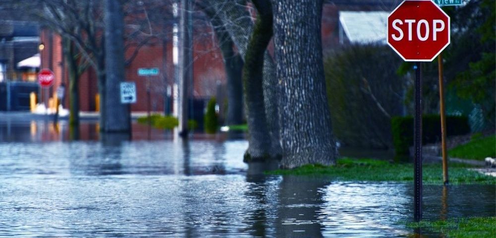
The UK has seen a significant shift in weather patterns over the last decade, with intense rainfall and rising river levels becoming more frequent. Because of this, local planning authorities and the Environment Agency have become much stricter about where and how we build. A Flood Risk Assessment is not just a map that shows if you are near a river; it is a technical evaluation of how water interacts with your specific site. It looks at the likelihood of flooding from all sources, not just the obvious ones, and provides a strategy to keep the building and its occupants safe for the lifetime of the development.
Understanding what a Flood Risk Assessment actually involves
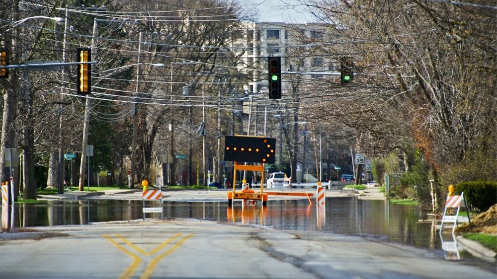
Many homeowners and developers assume that if they haven’t seen a flood in twenty years, their site is perfectly safe. Unfortunately, the planning system operates on a much longer timeline, often looking at 1-in-100-year events and accounting for the projected impacts of climate change over the next century. A comprehensive assessment goes deep into the data to identify potential vulnerabilities that aren’t visible to the naked eye. It considers several different types of flooding that could affect a property:
- Fluvial flooding: This occurs when rivers or streams overflow their banks due to excessive rainfall or snowmelt.
- Tidal flooding: Relevant for coastal areas or properties near estuaries where high tides and storm surges can push water inland.
- Pluvial flooding: Often called surface water flooding, this happens when heavy rain cannot soak into the ground or enter drainage systems quickly enough.
- Groundwater flooding: This occurs when the water table rises above the ground surface, often after prolonged periods of wet weather.
- Sewer flooding: When the local drainage infrastructure becomes overwhelmed and backs up into properties.
The assessment will categorise the site into a specific flood zone based on these risks. You might find that even if your property is located in an area generally considered low risk, a bespoke Flood Risk Assessment is still required if the site is over a certain size or if there are known local drainage issues. This document provides the evidence needed to convince planners that your project won’t increase the risk of flooding elsewhere, which is a major concern for local councils.
The role of the National Planning Policy Framework
In England, the National Planning Policy Framework (NPPF) sets out the government’s planning policies and how these are expected to be applied. It places a heavy emphasis on directing development away from areas at highest risk of flooding. This is achieved through the Sequential Test and, if necessary, the Exception Test. The Sequential Test is essentially a way for planners to check if there are alternative sites available for your project in areas with a lower risk of flooding. If you are renovating an existing building, this is usually straightforward, but for new builds on vacant land, it can be a rigorous hurdle.
If a project must be built in a higher-risk area, the Exception Test comes into play. This requires the developer to prove that the project provides wider sustainability benefits to the community that outweigh the flood risk, and that the development will be safe for its lifetime. Your assessment will be the primary tool used to provide this proof. Without a high-quality report, the planning department is likely to reject the application out of hand to avoid future liabilities.
What specific details make up a robust assessment
A professional report is much more than a simple summary of a map. It involves detailed hydraulic modelling and a thorough review of historical data. When a consultant prepares the document, they will typically include several key components to satisfy the local lead flood authority. These components are designed to provide a holistic view of the site’s relationship with water.
- Topographical survey data: This involves precise measurements of the land levels on your site compared to the surrounding area and nearby watercourses.
- Flood levels and depths: Using data from the Environment Agency, the report will estimate how deep the water might get during an extreme event.
- Mitigation measures: This is the ‘solution’ part of the report, detailing how you will protect the building, such as raising floor levels or using flood-resilient materials.
- Evacuation plans: Safe access and egress routes must be identified so that occupants can leave the property safely during a flood.
- Impact on others: A crucial part of the report is proving that your new building won’t displace water onto your neighbour’s land, potentially causing them to flood.
By addressing these points, the assessment transforms from a hurdle into a design tool. It allows your architect to adjust the plans early on, perhaps by changing the landscaping to include Sustainable Drainage Systems (SuDS) like rain gardens or permeable paving. These features not only manage water but can also add aesthetic value and biodiversity to your project, making it more likely to receive a positive response from planners.
Dealing with the impacts of climate change in your plans
One of the most significant aspects of a modern Flood Risk Assessment is the inclusion of climate change allowances. The Environment Agency regularly updates its guidance on how much extra rainfall or river flow we should prepare for in the coming decades. Currently, assessments often have to factor in a 20% to 40% increase in peak river flows depending on the location and the lifespan of the building. This forward-looking approach is why many people are surprised by the requirements; they are being asked to build for a future that looks different from the past.
Ignoring these projections can lead to serious issues down the line. If a property is built without considering these future risks, it may become impossible to insure or very difficult to sell in ten or twenty years. Mortgage lenders are increasingly scrutinising flood risk data before approving loans. By investing in a proper assessment now, you are essentially future-proofing your investment and ensuring that the property remains a viable asset for decades to come.
How professional advice saves you time and money
It can be tempting to try and source this data yourself or use a basic automated online service. However, these generic reports often lack the site-specific detail required for a successful planning application. When a planning officer sees a report that doesn’t address local nuances or fails to use the latest climate change data, they will likely ask for more information, which can lead to months of delays. In some cases, they may even object to the application entirely, forcing you to start the process again from scratch.
Working with a specialist consultant allows you to identify potential problems before they become expensive mistakes. For instance, if the assessment shows that floor levels need to be raised by 300mm, it is much easier to adjust the architectural drawings before they are submitted than to try and change the design after the council has raised an objection. A professional consultant can also liaise directly with the Environment Agency on your behalf, negotiating the best possible outcome for your site while ensuring all safety standards are met. This proactive approach often results in a smoother planning process and a more resilient final build.

Olivia Bennett is a news and lifestyle writer who specializes in consumer advice, entertainment updates, and travel insights. Her articles offer clear, concise information to help readers make informed decisions.